These were days of exploration on the Hilo side of Hawaii; first, a day spent north of Hilo.
The old road past Onomea Bay is now a scenic route, bypassed by the main highway. A narrow and wonderfully twisty road, it offers a glimpse into a Hawaii of many years ago. Just before the old road hits the new highway, there is a right turn that goes down through old an sugar plantation to Pepeekeo Point. Sugar growing in Hawaii ended in the mid-’90s when foreign sugar hit the market much cheaper than could be grown in Hawaii.
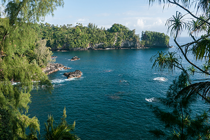
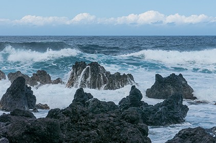
A view from a short walk down from the road. Blue water and sky, waves and rocks. There is a notch in the rocky point in the distance. This used to be a sea arch. It collapsed during an earthquake in 1956.
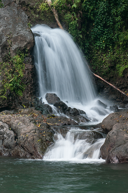
One of the tourist “must sees” near Hilo is Akaka Falls. “Akaka,” in Hawaiian, means a rent or split. The height of the falls measures 422 feet. First thing in the morning, it is pretty quiet on the trail, few tourists. By mid-morning, the big buses arrive with lots of tourists.
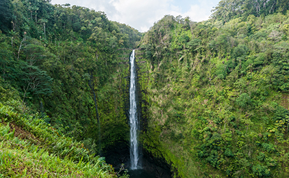
First thing in the morning, the parking lot and trail is pretty quiet. Later, the big buses bring lots of tourists to view the 422-foot waterfall.
The roar of the waterfall.
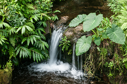
An interesting (amazing actually) thing about this falls is that there is a fish that actually ascends the falls!! Called the ʻOʻopu ʻalamoʻo, a type of goby native to Hawaii, this little 5-inch-long fish spends part of its life in the ocean, then swims 22 miles to Akaka Falls, where it uses a sucker on its underside and its pectoral fins to climb the slick rocks beside the water fall. Once up, it spawns. The embryo will then drift down to the sea to start their part of the cycle. There is also a native shrimp, the 2-inch-long ʻōpaekalaʻole, that has a similar life cycle and also climbs beside Akaka Falls to find its preferred breeding area.
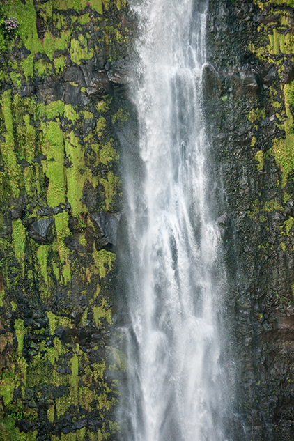
This is what the ʻOʻopu ʻalamoʻo and the ʻōpaekalaʻole climb to reach their breeding grounds.
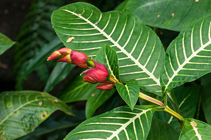
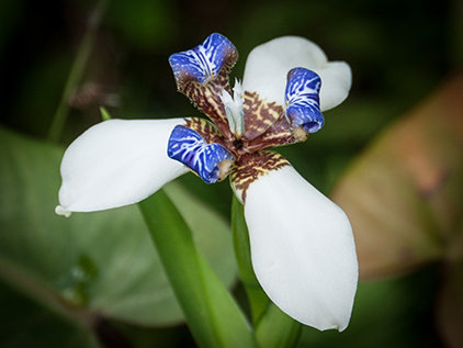
Sights along the trail to Akaka Falls.
Banyan Trees are common all over Hawaii but are not native. They were imported during sugar-plantation days. Without the tree-specific pollinator wasps to do the pollinating, the trees were propagated by cuttings. Then, in the early 1900s, in an effort to restore degraded watersheds, trees and the wasps were imported. A couple of the wasp species survived, allowing the trees to invade native forest, where they are now considered weeds, albeit rather large weeds. Some banyan trees can reach an acre in area.
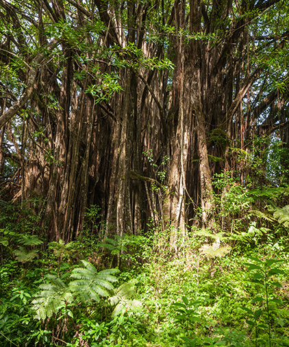
A non-native banyan tree in the natural preserve around Akaka Falls.
On Banyan Drive, in Hilo, there are many banyan trees dedicated to notable people such as Babe Ruth and Cecile B. deMille and to notable Hawaiians. They all survived the tsunamis that have hit Hilo since they were planted.
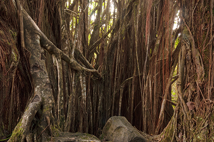
These two trees are in the otherwise native/natural forest around Akaka Falls—evidence of the ubiquitous of the banyan tree, these days.
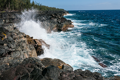
Further up the NE coast of Hawaii is Laupahoehoe Point, a beach park. It IS a park, but the “beach” is very rocky and on this day was battered by waves, making interesting sounds amongst the myriad rocks.
Surf pounding on the rugged rocks of the point create an endlessly swirling froth. The Hilo (windward) side of Hawaii is not blessed with very many sandy beaches.
At the end of the main highway is the Waipio Valley Overlook. You can learn a lot about the Waipio Valley from searching the web. The Wikipedia article gives you a good start, such as that the road down into the valley requires 4WD (all-wheel drive were not permitted) and that gradients average 25%—the rental car was just a 2WD sedan. The black sand beach at the mouth of the valley is popular with surfers. There was an ancient Hawaiian palace in the valley.
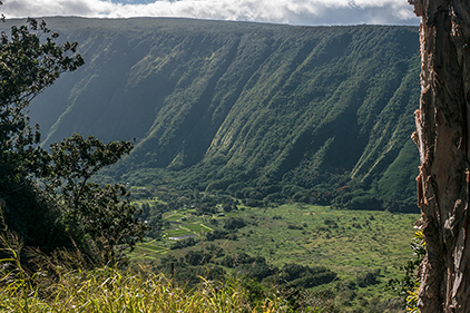
There are several deep canyons on the far northeast coast of Hawaii, carved into the oldest volcano making up the island, Kokala.
The road access to this valley is steep and narrow. The sign at the top demands true 4WD because the road AVERAGES 25% with steeper sections.
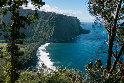
The surf crashing onto the black sand beach is popular with surfers, I understand.
The People’s Theatre in Honokaʻa was built in 1930. The small fly loft caught my eye. This was not just a movie theatre but should be used for shows that required scenery to change. Turns out there are many similar theatres on the island of Hawaii, small theaters for movies, plays, and other shows, built in the sugar plantation days. Shows would tour from town to town.
The People’s Theatre is in a money bind, currently, because they need to spend $60,000 on a digital projector or they will have to stop showing movies. Movie distribution is nearly all digital, now.
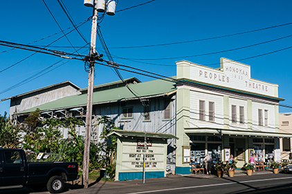
Note the small fly loft.
The beach park is in a deep “gulch,” as they are called on Hawaii, with a small rocky beach and the Mamalahoa Highway passing high overhead on a bridge. This small waterfall attracted my photographer’s eye.
The next day was for exploring the area south of Hilo. First stop was the Kumukahi Lighthouse.
Harvey, the bus tour guide, told a story about an old woman who was going to businesses and houses asking for food. Sometimes she would be helped; often she would be sent away and not helped. In the story, the old woman was associated with Pele. When the lava came to the town it spared the houses and businesses of the generous people in Kapoho.
Lava flows can be quirky. The 1960 lava flow that destroyed most of Kapoho came right up to the Kumukahi Lighthouse (located on the eastern most point of Hawaii), the leading edge pausing at the edge of the concrete slab before splitting into two streams and flowing on either side of the lighthouse tower, leaving it undamaged.
The 1960 lava flow flowed around the lighthouse tower and did not damage it.
The sounds of the waves against the rocks at McKenzie State Recreation Area.
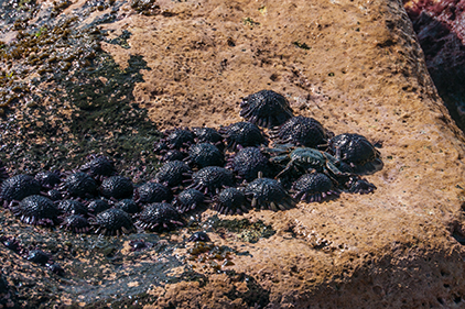
These are strange-looking (to me) creatures that it took some searching to figure out. Guessing they might be sea urchins helped the web search for what they were. They are also called shingle urchins. Note the crab on the right end of the urchin cluster.
The sound of the recordist getting soaked by a wave at McKenzie.
Pahoa has been under threat of lava flows since June 2014. Called the “Puna lava flow,” the end closest to Pahoa is about 500 meters from highway 130 and the downtown of Pahoa. The tip of the lava glow partially overran the recycling center but has been stalled for a couple of months (as I write this). Small outbreaks further uphill have presented no danger to Pahoa.
Will the flow reactivate? Will Pahoa be safe? We’ll find out. Harvey the tour guide’s prognosis is that the lava will flow through Pahoa by the end of the year.
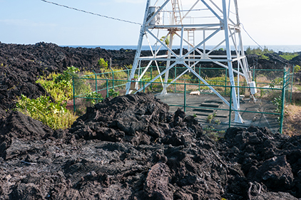
In the meantime, the town has taken what steps it can by protecting the power poles in the swale where the live might flow through. One pole further up hill has been saved by the steps down shown in the photo at right. In the event Highway 130 gets cut off by lava, the National Park Service has created a rough road extending the Chain of Craters road back along the shore, the original route before lava covered it. Then Pahoa residents could still drive to Hilo, although the drive will take two or three hours, through Hawaii Volcanoes National Park, instead of 20 minutes, as now.
An old pahoehoe flow that is slowly being eaten away by the ocean waves.
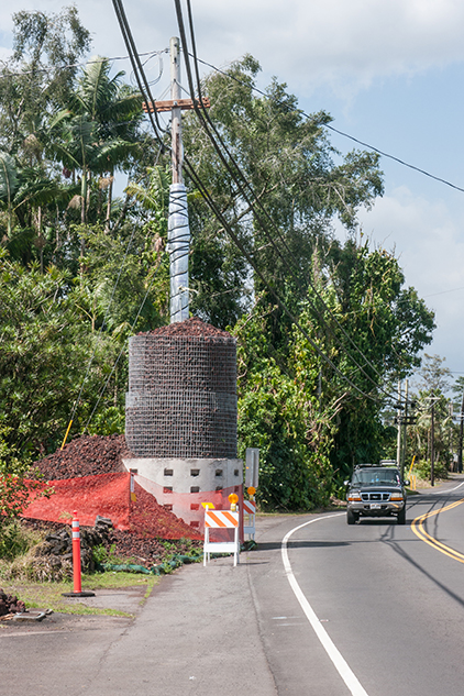
Pahoa protected several power poles in the projected danger of the lava flow. One such installation, uphill from here, did protect the pole.
After a day of exploring around Hilo, the meat of the visit was at hand: six days in Volcano Village to explore Hawaii Volcano National Park. After finding the lodging for the week, and moving in, it was time to head back to the Jaggar Museum and the Kīlauea viewpoint. The parking lot was jammed, as the sun was setting. A ranger was directing traffic and putting people in places that were not paved parking spaces.
Kīlauea was a popular sight at night. Finding a spot that wasn’t crowded but afforded a nice camera view, I set up my tripod and camera and proceeded to take photos for next couple hours. While watching, I struck up a conversation with a young woman and her mom, who were visiting Hawaii.
We shared the evening with Margaret and her mom, Peggy. As we were beginning to get chilly, we looked around and realized nearly everyone else had already left. But the lava light show would go on all night.
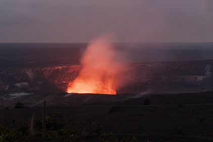
Kīlauea at night from the Jaggar Museum.
These are the night sounds that surrounded the Hiker’s Retreat, singing tired travelers to sleep.
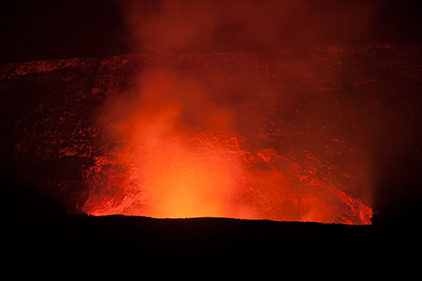
Kīlauea at night from the Jaggar Museum.