Kona & North
The days on the Kona Coast were sunny and warm (as expected) and windy (not expected). One plan had been to pay for a tour to the top of Mauna Kea that would extend into the night. There are several large telescopes on the top of that extinct volcano, taking advantage of some of the best “seeing” in the world. I wanted to see the sky from that 13,000' location. But it had been very windy on the summit for a week and forecast to be very windy for another week. Winds on the summit were ranging from 60–90 mph. No tourists allowed. There was plenty to do without that tour.
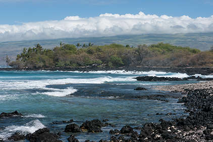
The west wind drives waves against rocky beaches as clouds cloak the summit of the extinct Kohala volcano, on the northern tip of Hawaii.
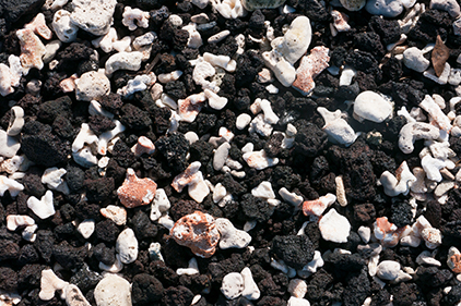
The coarse beach “sand”—a mix of lava bits and coral pieces.
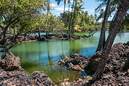
The Kahapapa and Kuʻualiʻi Fish Ponds are surrounded by the Waikoloa Beach Resort. These fish ponds, where Hawaiians would both capture and also raise fish for consumption, are now merely resort decoration.
Up the coast from Kona was the Puʻukohola Heiau, a National Park historic site. A heiau is a temple—a ceremonial site—and the Puʻukohola Heiau was one of great importance. Constructed under the leadership Kamehameha the Great, it apparently took a year to build (1790–91). This sacred temple involved a 25-mile-long human chain to bring stones, hand to hand, from the Pololu Valley on the other side of the island to the temple site. Events at this site were instrumental in Kamehameha’s unification of the Hawaiian Islands under his rule.
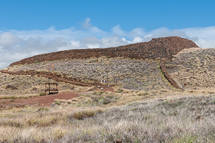
A heiau is a temple—a ceremonial place. This site played an instrumental part in Kamehameha the Great’s successful unification of the Hawaiian Islands.
Wind through trees is not all the same. This is what the fairly strong wind at the Puʻukohola Heiau sounds like in a broadleaf tree.
There are no palm trees in Alaska. I was amazed by how much the wind through this palm tree sounded like rain on my porch roof in Juneau.
The view of the puffy clouds atop the Kohala volcano did not hint at the winds. Once up to the cloud base on Highway 250, the winds were fierce, with the fog rushing across the road. It was not raining, but the ironwood trees alongside the road were capturing the moisture and dripping it like rain, along with shedding leaves and branches.
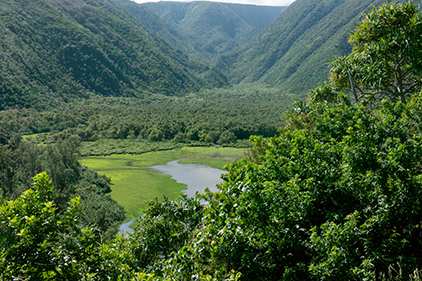
Kohala is the oldest of the volcanoes that make up the island of Hawaii. The west side is dry and not much eroded. The rainy east side has several deeply incised valleys.
Different trees produce different sounds in the wind. This is a recording of wind through the “needles” of the ironwood tree.
This broadleaf tree makes a different sound in the strong wind compared to the ironwood.
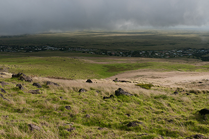
On the slopes of the Kohala volcano. To the left is Waimea, to the right the road down toward Kona.
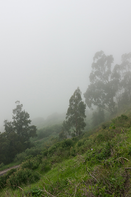
The high pastures of the Kohala are verdant. Fog may be a reason.
The Pololu Valley was a hiking goal. The end of the road was packed with cars from other hikers. Going down was easy; coming up was a bit more difficult on the steep trail. I have seen the beach described as a “black sand” beach, but the sand color was a medium grey. The strong winds were causing williwaws on the water and ripping through the trees, knocking a small palm tree down on the trail. Driving back toward Hawi, I found a large tree had blocked traffic. The road crew was trying to clear it out of the way enough so there was one lane.
In the town of Hawi, there was no food to be had, except at the small barbeque stand, because there was no electricity, due to wind damage. Cell-phone service in Kona was impaired for several hours due to the wind. Gusts on top of Mauna Kea were forecast to have reached 105 mph.
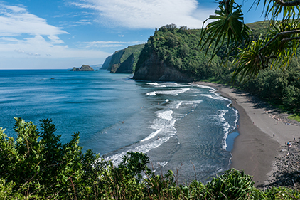
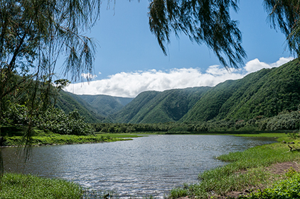
At the end of the road, a steep foot trail descends into this northernmost of the valleys incised into the northwest shore of Kohala.
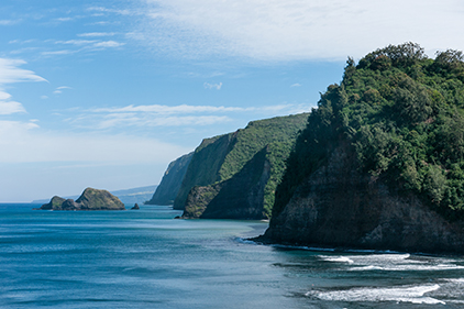
These headlands are the result of an enormous landslide, about 250,000 years ago, that cut back nearly to the summit of Kohala. These cliffs are the headwall of the ancient avalanche.
Before Europeans arrived, taro was farmed here.
European contact allowed the addition of rice as a crop. In the 20th century, farming in this valley disappeared.
The Kona coast, being drier, preserves human artifacts better than the windward, wetter east coast of Hawaii. On one old pahoehoe lava flow near the Waikoloa Beach Resort was a large area of petroglyphs. In the presence of these old human artifacts, I always wonder what life was like for them, so different than our car- and grocery-store-driven lives.
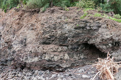
A cross section of the many lava flows that created the Kohala volcano can be seen in the cliff face.
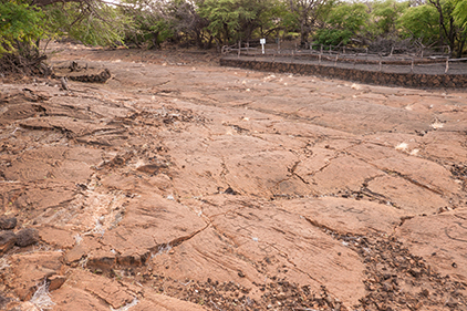
The smooth, flat surfaces of some pahoehoe lava flows allow for petroglyphs.
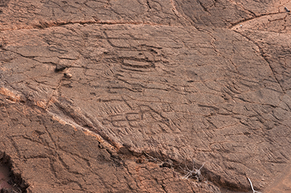
Human figures, boats, animals, perhaps astronomical symbols are all subjects of the rock art. This area is actively protected by the Waikoloa Beach Resort.