Saddle Road
I had heard stories about the Saddle Road, the road between the east and west coasts of Hawaii, between Hilo and Kailua/Kona, that passes over the “saddle” between Mauna Kea and Mauna Loa—rough, winding, not a place for rental cars. It turned out those stories were old—to my disappointment. In 2013, the final section of the Daniel K. Inouye Highway (Highway 200) opened. Wide and straight, it replaced the twisty route and crumbly asphalt of the old Saddle Road.
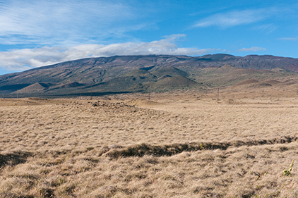
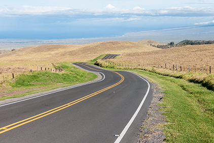
The saddle between Mauna Kea (under clouds) and Mauna Loa is grassland on the Mauna Kea side of the highway and lava flows on the Mauna Loa side.
I was struck by the sharp vertical edge to the vog line—fumes from Kīlauea that have blown onto the Saddle but not mixed with the air. You can see the clear blue sky on the right. As you scan across the photo to the left, you see the blue change to a brownish haze. Vog—volcanic smog.
The views and terrain—the lava flows—are still worth the trip, even if the driving is not as adventurous. Plus, an old stretch of the route still exists on the west side of the Saddle, as a deviation to Waimea, if you want to actually drive your car.
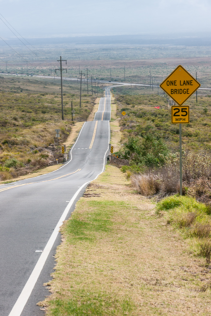
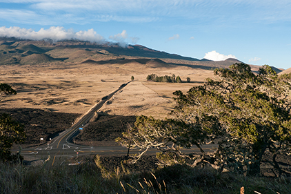
Looking east down what use to be the Saddle Road. The intersection in the distance is the connection to the new, improved Highway 200, between Hilo and Kailua.
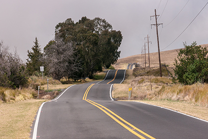
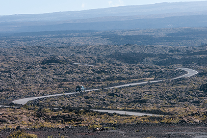
I wish I had visited before the road improvements over the Saddle, but there is still a stretch of highway heading toward Waimea that is the original Saddle Road, narrow and twisty with ups and downs.
The old route of the Saddle Road twists and winds around Mauna Kea as it descends toward Waimea.
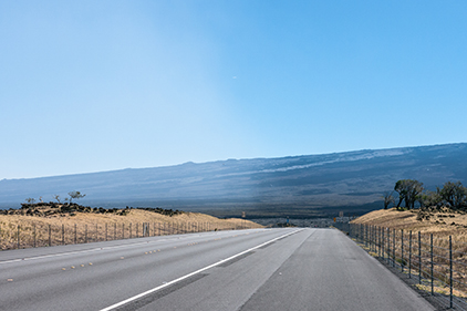
The west side of the Saddle Road climbs through grasslands. The east side quickly climbs out of the rain forest into a rough and rocky scrubland, meeting at the 6,600' high point grass lands. Sheep used to be raised on the land.
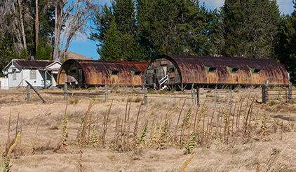
The Humuʻula Sheep Station is in the cluster of trees just right of center. The road past the station leads to Mauna Kea. The highway going left and right is the new Highway 200.
Sheep-raising began here in 1863. Later this land became part of the huge Parker Ranch. Sheep raising ended in 1963, though cattle ranching continued until the Parker Ranch’s lease ran out in 2002.
The Saddle Road is pretty much the dividing line between the grass-covered ancient lava of the extinct Mauna Kea to the north and the mostly barren lava flows of Mauna Loa, the largest volcano on Earth and one of the most active. Both Mauna Loa and Mauna Kea are over 13,000 feet, but they don’t look that tall. The shape of shield volcanoes is a long gentle slope to the top. For example, the northeast rift zone of Mauna Loa has a continuous slope on the upper 7,000 feet of the volcano of about 8%—not steep and dramatic. They look like big, distant hills.
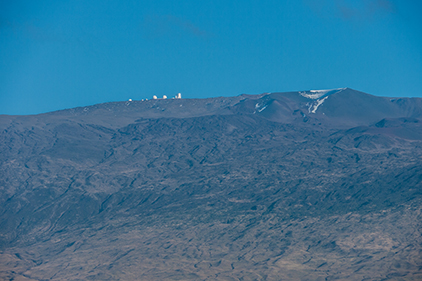
A telephoto picture taken on the old Saddle Road, of the telescopes on top of Mauna Kea, 8,000 feet above and 9 miles distant.
The lava flows of Mauna Loa and the grasslands of the Saddle.
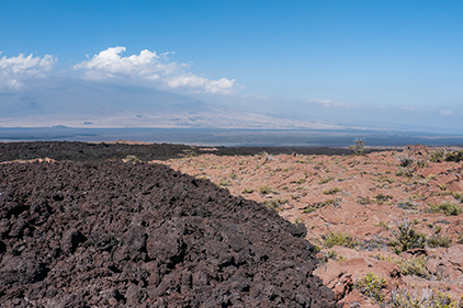
Mauna Loa frequently paves its slopes with lava and then repaves them. The reddish rock is aged pahoehoe lava. The dark rock is is much more recent aʻa lava.
At the junction of the road to Mauna Kea, there is an old cinder cone (Koa Kīpuka) that provides an elevated viewpoint. It stands a couple hundred feet above the surrounding Mauna Kea lava flows. The cone has been fenced to preserve the kipuka vegetation in its near-natural state from nonnative animals.
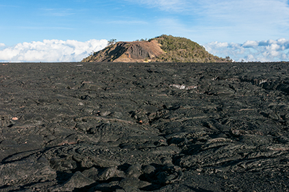
This is an eroded and excavated cinder cone that is now set aside as a plant refuge in the middle of Mauna Loa lava flows. There is a fence around the entire cinder cone to prevent unwanted animals from entering.
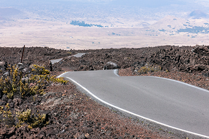
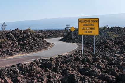
Just to the east of the Koa Kīpuka is a single-lane asphalt road with an old, broken surface. This is the road to the Mauna Loa Observatory, a weather station for NOAA. Right after the warning sign about dangerous conditions on the road, the surface turns smooth from recent resurfacing. It winds through and over numerous Mauna Loa lava flows, effortlessly climbing a couple thousand feet. Not a road for large vehicles or speedy travel, it takes you through vast Mauna Loa lava flows.
The start of a single-lane road that leads to the Mauna Loa Observatory (NOAA) and to a telecommunications site.
This is the rugged, one-lane road that climbs over the Mauna Loa lava flows to the NOAA Observatory and telecom site. There are many blind corners and few places to pull over to let an oncoming car go by.
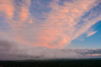
Looking toward the Hilo side of Hawaii. At 6,000 feet, we are above the clouds over Hilo. The sun is still lighting the cirrus clouds in the orange of sunset.